|
Neptune Terminals is a shipping terminal on the North shore of Burrard Inlet that specialized in potash, steelmaking coal, and phosphate rock. From their website the following is about where the materials come from and what they are used for: Potash Potash is a naturally occurring, water soluble crop nutrient that is crucial to agriculture worldwide. Potash is a major ingredient in commercial fertilizers, which typically contain potassium (from potash), nitrogen and phosphate. Saskatchewan, Canada is the world’s largest producer of potash, producing about one quarter of the world’s supplies. Steelmaking Coal The Canadian steelmaking coal handled at Neptune Terminals is used in the production of steel. Steelmaking coal is transported by rail from southeast British Columbia and northwest Alberta before being loaded onto ships at Neptune Terminals. Much of the coal we handle is destined for the steel mills of Korea, Japan and China. Phosphate Rock Phosphate rock, an inert sand, is an essential plant nutrient and a key link in the global food chain, which helps feed the world. The product, from Morocco, is similar to coarse beach sand. As a result, it is easier and most efficient to handle when dry, so is covered for transportation and storage. It was fascinating to see the sheer volume and size of the terminal. The trains that deliver potash and coal are more than half a kilometer long. And the piles of coal and potash sheds, while they appear quite large from the road, are staggeringly large once you get right up to them. All in all it was a fascinating trip to this bustling terminal.
1 Comment
I had a great conversation with Chief Ian Campbell of the Squamish Nation the other day. We talked about everything from colonization and residential schools, to language, to cultural appropriation. The interview below is just an excerpt of our conversation focused on language and identity. The Squamish Nation is one of 3 nations that call Burrard Inlet home. The others are the Musqueam and Tsleil-Waututh. For thousands of years this shores of the Burrard Inlet were managed and shared collectively among various Coast Salish people. Today, the Squamish govern their territory through a council of 16 elected officials that has essentially supplanted the traditional system of 16 hereditary chiefs. Historically, there was great care and concern with managing the land as a resource and each of the chiefs would be responsible for a local area or resource. When Europeans first arrived the combination of the gold rush mentality that sees the land as a vacant resource for the taking (and all the accompanying environmental destruction that goes along with it), disease such as small pox that decimated entire villages, and the intentional cultural genocide through missionary work and residential schools the Squamish nation was left in peril by the time the last residential school on the North Shore was closed in 1956 and the system of hereditary governance was no longer effective. A slow but deliberate process is taking place to revitalize the Squamish and other local nations. With steps like naming rights, language programs at places like SFU, and the inclusion of indigenous perspectives in education the culture is becoming stronger. And with land use agreements and economic negotiations the Nation is becoming increasingly self-sufficient. Chief Ian Campbell concludes our interview saying that, “we can’t go backwards to the way it was during my grandparent’s era. It’s about applying traditional knowledge in a modern context”. Port Moody is a beautiful and bustling little city hiding away at the East end of the Burrard Inlet. I just wanted to get an introduction to the waterfront and go for a quick paddle but it quickly turned into a fascinating tour of a mixed waterfront. Industrial and recreational uses seem to compete for every inch of waterfront and I saw wildlife, commercial shipping operations, high school canoe lessons, lumber mill activities, and more. Most notably, I watched a chemical tanker, probably loaded with ethylene glycol, pull away from its berth and make its way out towards the second narrows. It was leaving from the Pacific Coast Terminals which is a massive operation specializing in the transportation ethylene glycol and Sulphur – both of which are byproducts from the production of natural gas and petroleum. After watching the tanker go by I checked out the Burrard Generating Station, sometimes called the Burrard Thermal Plant. It is a 900 megawatt conventional natural gas-fired generating station. While this tour took on a notably industrial tone I will be back soon to check out the amazing history and geography of the area. I am especially fascinated with the huge shell middens and artifacts from First Nations that have occupied the region for the last 10 thousand years. Just think about that for a moment. That is roughly 400 generations. Compare that to the 9 generations since the first European visitors to Burrard Inlet and the Coast Salish claims to the land become even more formidable. Enjoy the video! I headed out from Ambleside beach to check out some of the navigational markers and buoys and established anchorages of English Bay. I saw the port and starboard lateral buoys for False Creek as well as the West Cardinal buoy off of Stanley park. Check out the Vancouver Port safe boating guide to see a full size map of all of Burrard Inlet including anchorages, shipping lanes, fishing areas, boat launches, and more. Sometimes it may just appear that the large commercial vessels are just parked wherever they can fit but there is significant controls and organization in place to help keep the Inlet safe for the environment and people. Please enjoy the short video tour of English Bay! I was lucky enough to get to sit down with Ken Robinson, a B.C. coast pilot for the last 24 years. I enjoyed our conversation immensely and could have asked him questions for hours. He told me about what it is that the pilots do, how the Burrard Inlet commercial operations work, and what industrial life on the inlet is like. Essentially, the B.C. Coast pilots command any large commercial vessels around 185 meters or longer of a certain weight. This includes freighters, bulk carriers, oil, chemical, and liquid tankers, cruise ships, and so on. They work with the Port of Vancouver to make sure commercial vessels pass through the harbour with the safety of people and the environment in the forefront. Coming soon is my tour of the Navigational Buoys in English bay that the pilots would use to help guide large vessels in but in the meantime check out Vancouver Port's safe boating guide that clearly shows the designated travel lanes and anchorage spots for all the vessels that use the Inlet. Please enjoy my conversation with Ken! 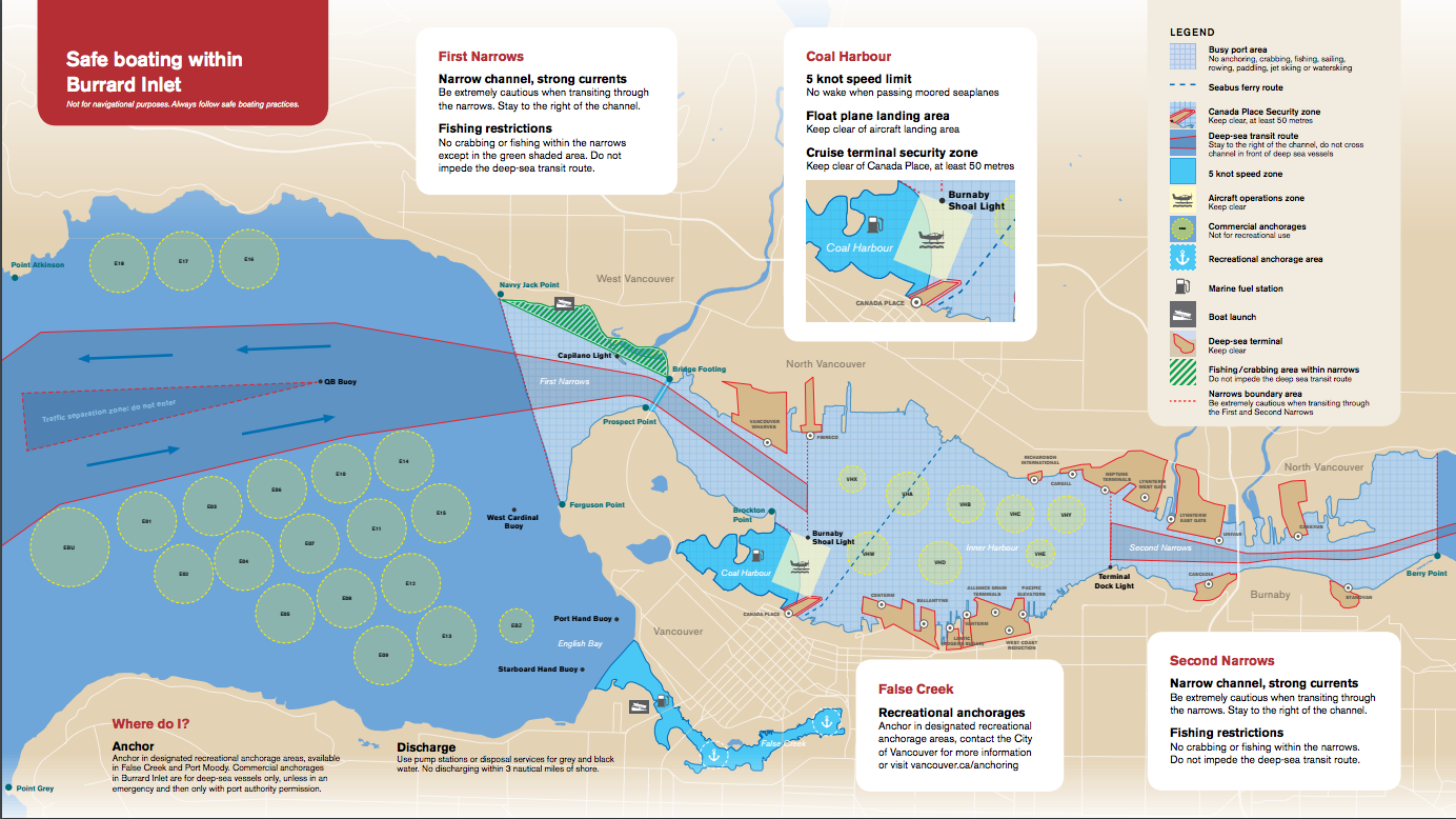 I had the chance to speak with Mr. Derek Corrigan, the Mayor of Burnaby for the last 15 years. We talked about a wide range of topics including conservation, the city’s relationship with First Nations, history, demographics, and education, but the issue of Kinder Morgan’s Transmountain Expansion pipeline came up again and again and became the natural focus of our talk. The Mayor’s, the official stance of the city, is adamantly against the project. For a quick primer on the project check out these two sites for and against: By now, most people have heard about the project and the main concerns including tanker spills, pipeline safety, and storage safety so close to an urban area. Mr. Corrigan shares these concerns but was also able to articulate a somewhat unique and interesting perspective on the overall project from a global perspective. Watch the full length interview FOLLOW THIS LINK.
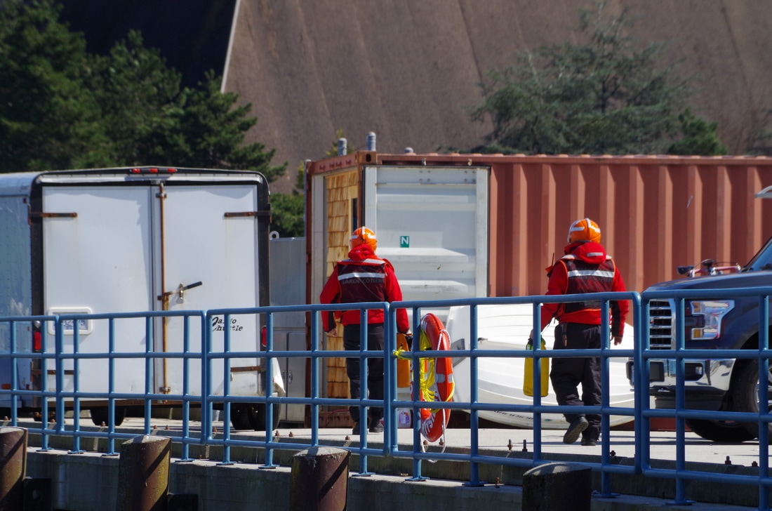
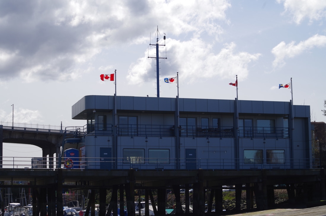
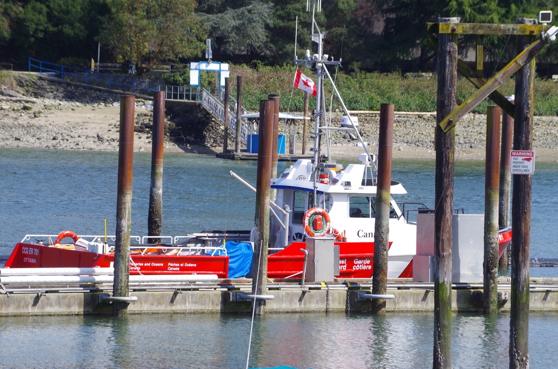
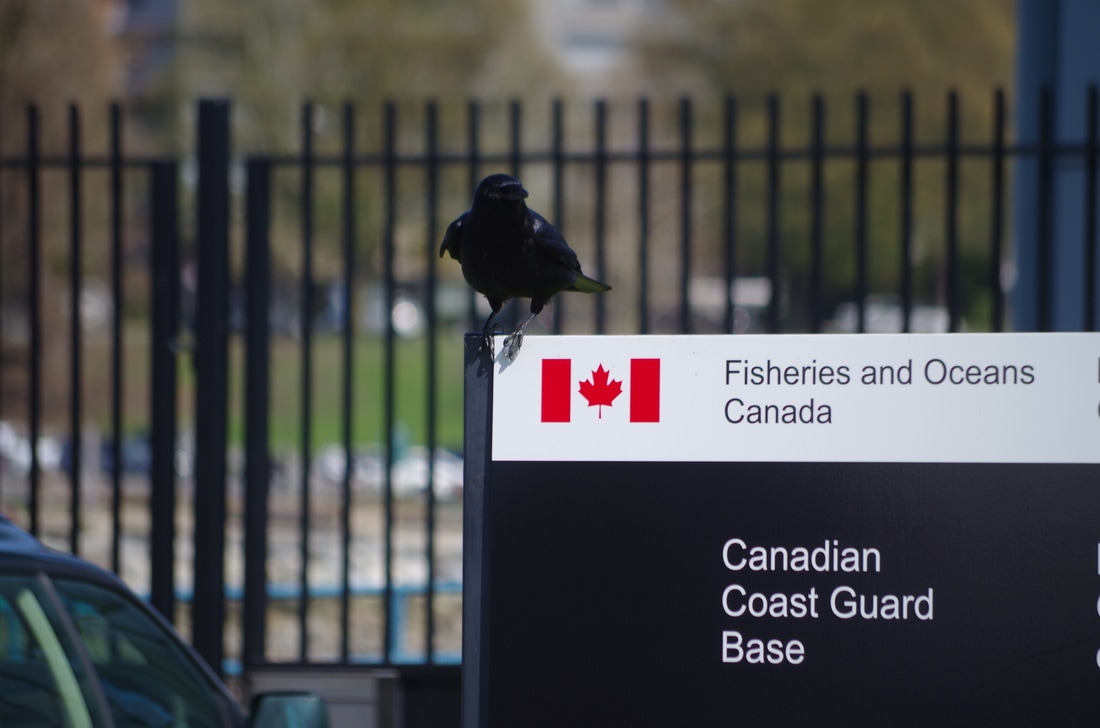
What a fantastic day out on the arm. Just before midday I headed up the arm for a rip up to Best Point. I saw all kinds of wildlife and only had to stop and pick up two pieces of garbage. It was pretty calm and the tide was slack so I could move at a good pace and not have to work too hard! What struck me the most, though, is how close this is to the city and how far away it feels. It was first mapped by European explorers on George Vancouver’s visit in 1792 and subsequently explored more closely by Galliano in the same year. But before that it was the traditional land of the Tseil-Waututh Nation and provided cultural significance and basic needs. In fact, it was said that, “when the tide went out, the table was set”. The arm was shared by neighbouring first nations and managed through negotiated band protocols. At the south end of the arm is the self described “uncity” of Deep Cove. The arm then stretches almost 20km north-east up to The Say Nuth Khaw Yum Heritage Park / Indian Arm Provincial Park where there is vibrant wildlife, waterfalls, and a large pink salmon run on odd numbered years. About halfway up the arm on the Eastern shore is the gothic looking Buntzen Generating station. It was originally built in 1903 and has been added to, renovated, and expanded many times since. It still provides some power to Vancouver. Finally, after my paddle I met up with a young intrepid user of Indian arm and asked him a few questions about living by this historic and beautiful ancient fjord. I had the chance to tag along with Surfrider today as they worked with Grade 8 students to clean up part of the shoreline in West Vancouver. I talked to the students about what they found, why they thought it was important, and what they got out of it. All the students were surprised at just how much garbage they kept finding. Cigarette butts and little bits of plastic seemed to be the most prevalent but they managed to find all kinds of stuff out there. As Kat Jayme, the vice chair of Surfrider Vancouver, puts it, "it's not necessarily about being perfect all the time . It's just about being more aware of our actions and what our actions are doing to the environment and how they're affecting other people". Our beaches and waterfront really does look quite clean at first glance, but it is this Check out the short video of the day below! My sincere thanks to the folks at the Canadian Coast Guard Base - Kitsilano. I had the chance to visit and talk about what they do on the inlet and how they keep us safe. The crew down there work and train tirelessly on our behalf. They have two primary functions:
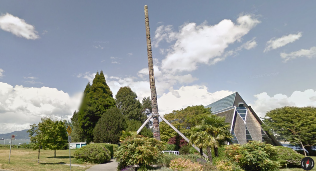
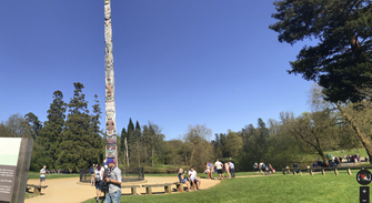
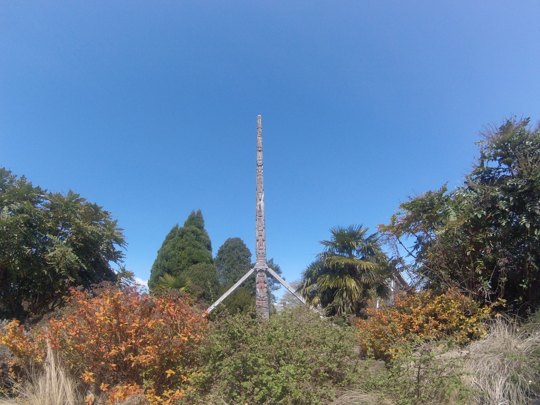
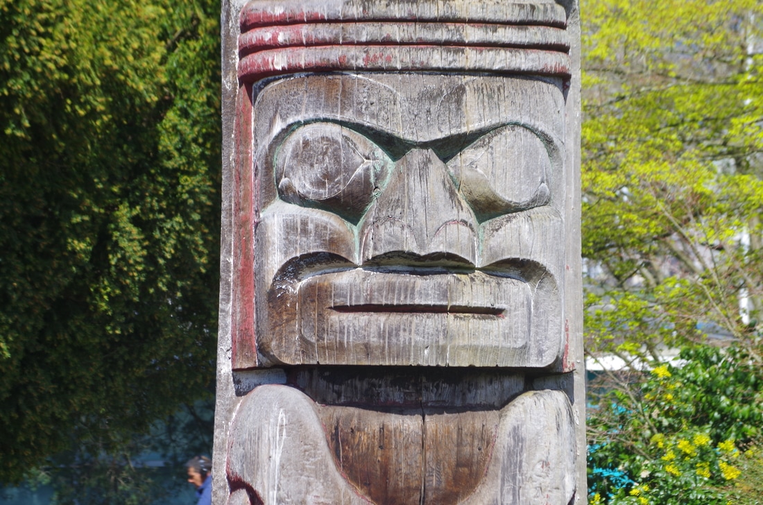
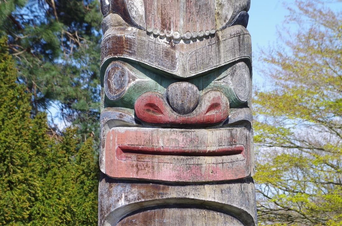
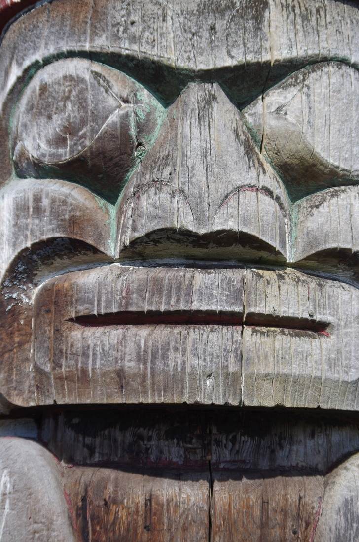
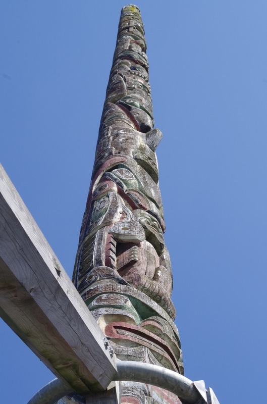
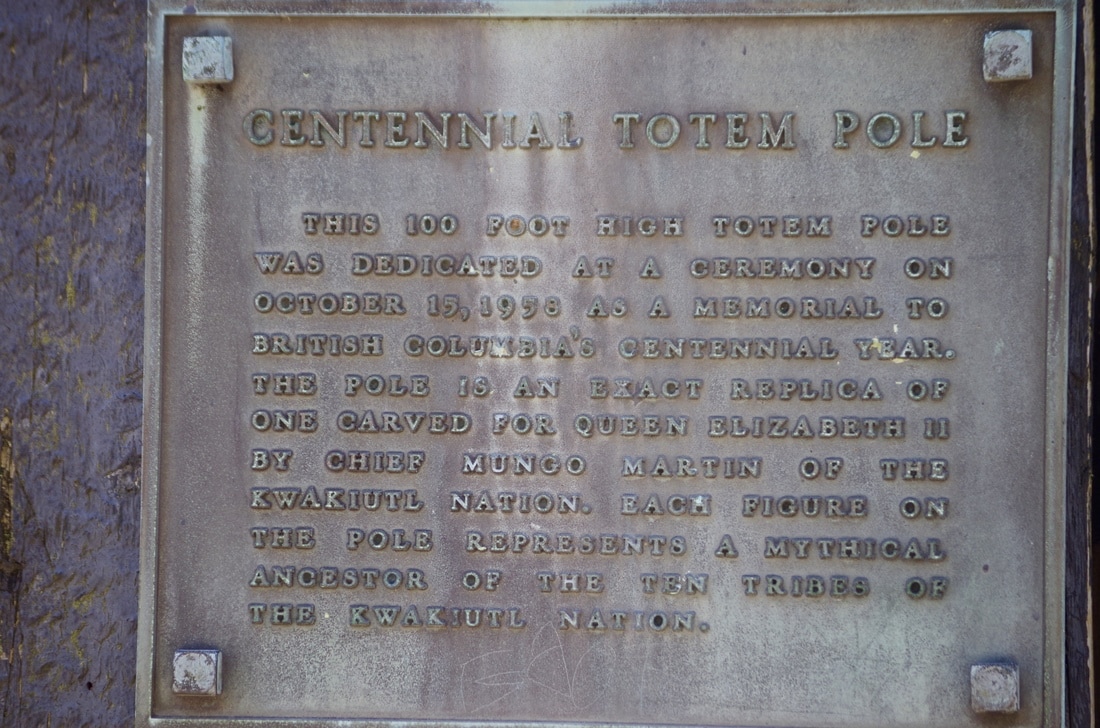
For search and rescue the Coast Guard respond to any emergency on the water as we discuss in the interview. The variety of calls they may get means they must have a diverse array of skills, training, and equipment. In terms of environmental response, you may remember the "small oil spill" in the spring of 2015. At the time of the spill, the Kitsilano base was actually closed but they would have dramatically improved the confusion and cost of the clean up as they could have been on site within about 5 minutes with dedicated environmental response equipment. Also, they are responsible for smaller spills from recreational users and land based spills that spread to the ocean. Overall, these folks do a great job of keeping us safe out there. See the full interview here. 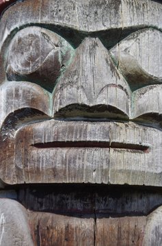 The Centennial Totem Pole, also known as the Kwakwaka’wakw Centennial Pole, is a 100 foot (30 meter) tall totem pole that sits just south of the maritime museum in Kitsilano. It was carved by Chief Mungo Martin, his son David, and his nephew Henry. Chief Martin had previously been forced to stop carving totem poles as part of the Potlach Ban that ended in 1952. He, and others, then began to revive the practice and art of pole carving. Two identical poles were made and one stands in Windsor Great Park, England. Click here to read an article about Sam Haydahl, the lumberjack who felled the original cedar for the poles, visiting the English site in 2014. History The pole was erected in 1958 as a memorial to British Columbia's centennial year. British parliament had established the Colony of British Columbia 100 years previously. Interestingly only about half of what we now call B.C. was in the original colony. Missing was part of B.C.’s north, east, Vancouver island, Haida Gwaii, and other coastal islands. Thoughts So far, out of the First Nations sites that I’ve visited there seems to be an understatedness that I rather enjoy. I don’t know if it is intentional, but when you compare the pole in Vancouver with the pole in England (screen shots from streetview below) you see that they’ve made a whole sitting area and destination whereas our pole is sort of left to speak for itself.
You can visit the English pole on google maps by clicking here. You can visit the Vancouver pole on google maps by clicking here. Further links Here is a great article from the CBC about the carver: http://www.cbc.ca/news/canada/british-columbia/centennial-totem-pole-renewal-mungo-martin-1.3614894 |
Archives
June 2017
Categories |


 RSS Feed
