|
What a fantastic day out on the arm. Just before midday I headed up the arm for a rip up to Best Point. I saw all kinds of wildlife and only had to stop and pick up two pieces of garbage. It was pretty calm and the tide was slack so I could move at a good pace and not have to work too hard! What struck me the most, though, is how close this is to the city and how far away it feels. It was first mapped by European explorers on George Vancouver’s visit in 1792 and subsequently explored more closely by Galliano in the same year. But before that it was the traditional land of the Tseil-Waututh Nation and provided cultural significance and basic needs. In fact, it was said that, “when the tide went out, the table was set”. The arm was shared by neighbouring first nations and managed through negotiated band protocols. At the south end of the arm is the self described “uncity” of Deep Cove. The arm then stretches almost 20km north-east up to The Say Nuth Khaw Yum Heritage Park / Indian Arm Provincial Park where there is vibrant wildlife, waterfalls, and a large pink salmon run on odd numbered years. About halfway up the arm on the Eastern shore is the gothic looking Buntzen Generating station. It was originally built in 1903 and has been added to, renovated, and expanded many times since. It still provides some power to Vancouver. Finally, after my paddle I met up with a young intrepid user of Indian arm and asked him a few questions about living by this historic and beautiful ancient fjord.
5 Comments
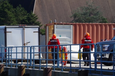
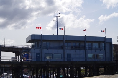
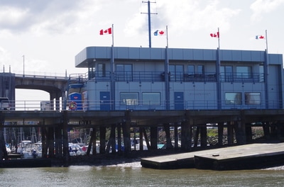
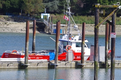
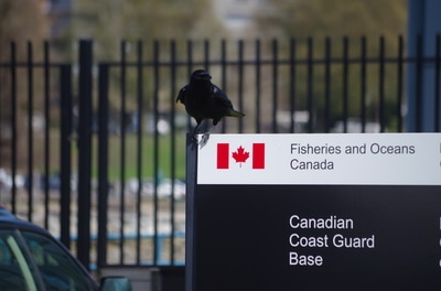
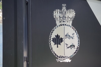
I had the chance to tag along with Surfrider today as they worked with Grade 8 students to clean up part of the shoreline in West Vancouver. I talked to the students about what they found, why they thought it was important, and what they got out of it. All the students were surprised at just how much garbage they kept finding. Cigarette butts and little bits of plastic seemed to be the most prevalent but they managed to find all kinds of stuff out there. As Kat Jayme, the vice chair of Surfrider Vancouver, puts it, "it's not necessarily about being perfect all the time . It's just about being more aware of our actions and what our actions are doing to the environment and how they're affecting other people". Our beaches and waterfront really does look quite clean at first glance, but it is this Check out the short video of the day below! My sincere thanks to the folks at the Canadian Coast Guard Base - Kitsilano. I had the chance to visit and talk about what they do on the inlet and how they keep us safe. The crew down there work and train tirelessly on our behalf. They have two primary functions:
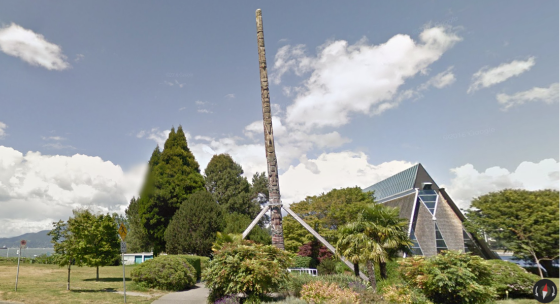
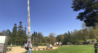
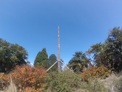
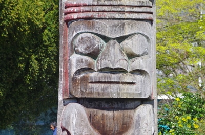
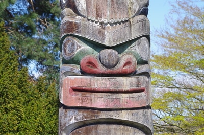
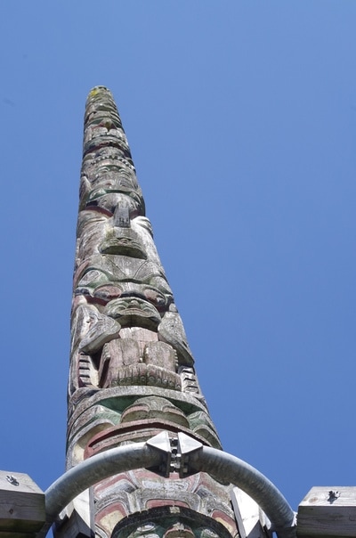
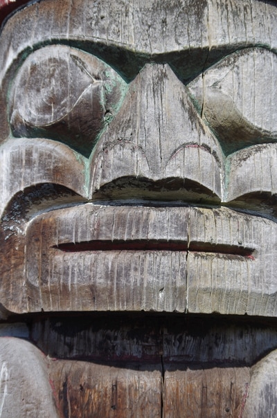
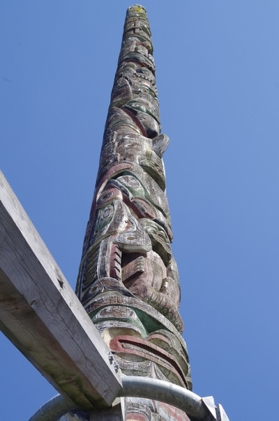
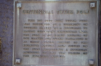
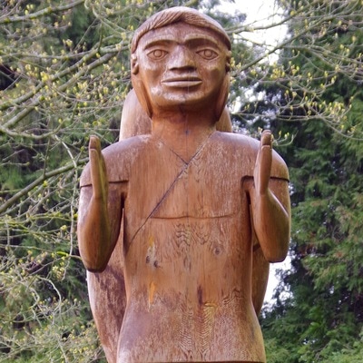
For search and rescue the Coast Guard respond to any emergency on the water as we discuss in the interview. The variety of calls they may get means they must have a diverse array of skills, training, and equipment. In terms of environmental response, you may remember the "small oil spill" in the spring of 2015. At the time of the spill, the Kitsilano base was actually closed but they would have dramatically improved the confusion and cost of the clean up as they could have been on site within about 5 minutes with dedicated environmental response equipment. Also, they are responsible for smaller spills from recreational users and land based spills that spread to the ocean. Overall, these folks do a great job of keeping us safe out there. See the full interview here. 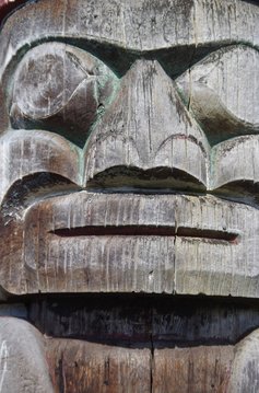 The Centennial Totem Pole, also known as the Kwakwaka’wakw Centennial Pole, is a 100 foot (30 meter) tall totem pole that sits just south of the maritime museum in Kitsilano. It was carved by Chief Mungo Martin, his son David, and his nephew Henry. Chief Martin had previously been forced to stop carving totem poles as part of the Potlach Ban that ended in 1952. He, and others, then began to revive the practice and art of pole carving. Two identical poles were made and one stands in Windsor Great Park, England. Click here to read an article about Sam Haydahl, the lumberjack who felled the original cedar for the poles, visiting the English site in 2014. History The pole was erected in 1958 as a memorial to British Columbia's centennial year. British parliament had established the Colony of British Columbia 100 years previously. Interestingly only about half of what we now call B.C. was in the original colony. Missing was part of B.C.’s north, east, Vancouver island, Haida Gwaii, and other coastal islands. Thoughts So far, out of the First Nations sites that I’ve visited there seems to be an understatedness that I rather enjoy. I don’t know if it is intentional, but when you compare the pole in Vancouver with the pole in England (screen shots from streetview below) you see that they’ve made a whole sitting area and destination whereas our pole is sort of left to speak for itself. You can visit the English pole on google maps by clicking here.
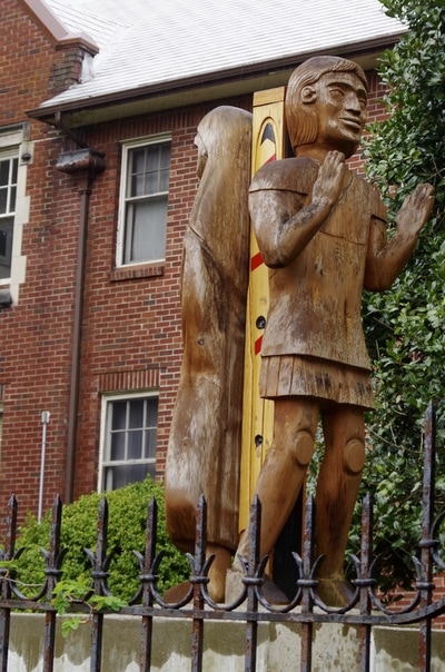
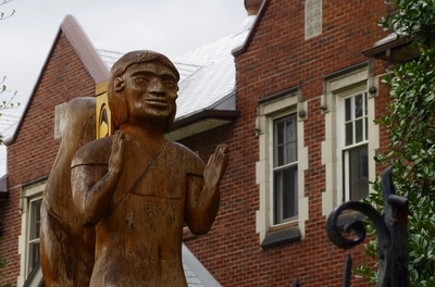
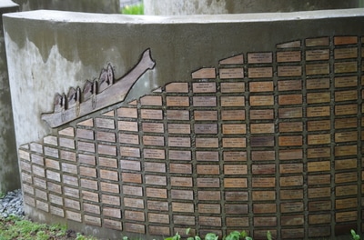
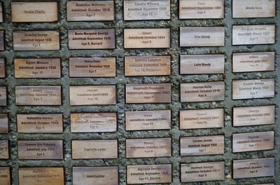
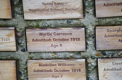
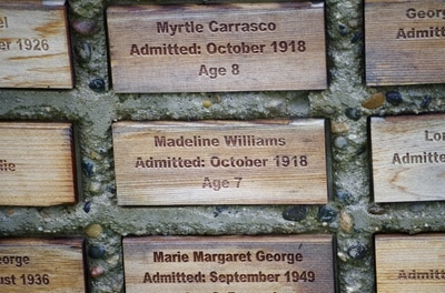
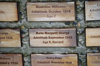
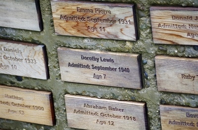
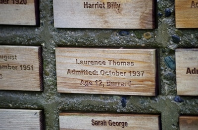
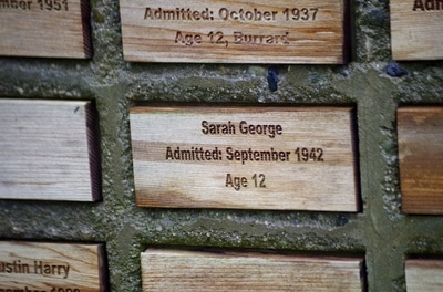
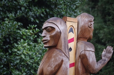
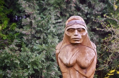
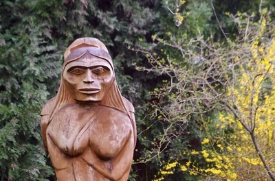
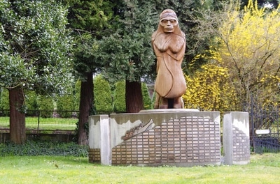
You can visit the Vancouver pole on google maps by clicking here. Further links Here is a great article from the CBC about the carver: http://www.cbc.ca/news/canada/british-columbia/centennial-totem-pole-renewal-mungo-martin-1.3614894 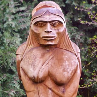 In December of 2015 the Truth and Reconciliation Commission released its final report. The Commission had been working since 2008 with the goal of acknowledging and promoting awareness of the Indian Residential School (IRS) legacy. Specifically, the commission was to create a report: … concerning the IRS system and experience including: the history, purpose, operation and supervision of the IRS system, the effect and consequences of IRS (including systemic harms, intergenerational consequences and the impact on human dignity) and the ongoing legacy of the residential schools I’ve had the distinct privilege over the last 20 years to work closely with and learn from First Nations people from across the country and have been witness to youth and elders rediscovering a culture that was all but stripped from them. I could easily see the scars left by the IRS system but I don’t think that most Canadians have this opportunity to begin to understand this stain on our cultural history. The commission, I think, did a great job of bringing awareness and understanding to the forefront and popular pieces of artistic work such as Gord Downie’s Secret Path or the graphic and assumption busting work of Kent Monkman are evidence that we, as a nation, are becoming aware and coming to grips with our past. Here on the Burrard Inlet we were in the thick of the IRS system. St. Paul’s Indian Residential School operated from 1899-1958 in North Vancouver. The school was located in what was then known as Ustlawn (Eslhá7an), which later became the Mission Indian Reserve No. 1 that it is today. Students of the school either came from this reserve or surrounding Squamish, Tsleil-Waututh, and Musqueam communitites, and in some cases from even further abroad. Tucked away just off the reserve is a monument to the survivors of St. Paul’s school. It was unveiled in June of 2014 and is a simple, yet stark, homage to those whose lives were impacted by the operation of the school. There are two figures, a man and a woman, standing back to back atop a column surrounded by small plaques with the names of former students. As I stood in the light rain taking pictures and viewing the installation I was moved by the resilience of Canada’s indigenous people. Many of the names on the small plaques had their age. Often only age 6 or 7. So, for almost 60 years (2-3 generations) young students were brought to the school in their most formative years and forced to shed their existing culture for a new one. Most communities would surely have been utterly destroyed in the face of such deliberate cultural genocide and yet here we are today with the final report of the Truth and Reconciliation commission making cultural and political waves all on the road to strengthening and honouring the culture of the people of this land. For further reading check out these links:
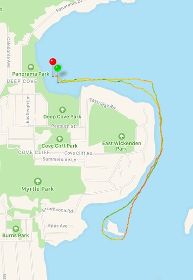 So I went out last night for my first ever stand up paddleboard (SUP) race. As it turns out, I was grossly underprepared and grossly over confident at the same time. First, my board. I use a beautiful Boardworks Great Bear SUP that is designed for loading up gear and heading out on a day trip or expedition. It can handle big waves and chop really well. It is the off road pick up truck of the SUP world... not the indy car. Strike 1. Second, my clothing and gear. The racers around me were using super light pull cord inflatable waist belts that satisfy the requirement for a personal floatation device without being too bulky or constrictive and think neoprene suits that didn't let them get easily overheated. I was in an expedition style life jacket complete with tow belt, knife, and pockets for emergency equipment and a full gore-tex drysuit complete with latex neck and wrist gaskets. I was the most comfortable guy on the starting line... strike 2! Finally, I've paddled for the last number of years through big waves and long distances and even surf on a SUP so I thought I had this little 4km course all but wrapped up. I didn't think I was going to win, mind you, but I didn't really think it was going to be much of a work out either. As such I didn't really fuel up with good food or water and wasn't really in a strong competitive mindset. Strike 3. The race starts and I'm off with the pack! So fun! The course left the Deep Cove government docks and headed out due East (see map). Things were going pretty well there and once I rounded the buoy to head South and pick up a tail wind things were feeling quite good. Most of the pack was out in front of me but, "no problem", I thought to myself. I knew they'd be a little quicker - especially off the start. I was hitting my top speed (in green) of 10.5 km/h and having a great time. About 1.5 km into the 4 km race, however, hauling my big heavy board with my bulky too warm clothing and personal flotation device proved much harder than I had anticipated. I was getting pretty hot and starting to slow my pace a little. Things really started to fall apart as I rounded Grey Rocks island. You see the little red dot in my route around the West side of the island? It was here that my fin hit a submerged rock and stopped my board dead in its tracks. The result, of course, was to throw me over the front of my board and into the water. I quickly clambered back onto my board and got underway again only to come around the East side of the island directly into a powerful and gathering headwind. According to the Canadian weather service, by that time, I was attempting to paddle directly into a sustained North East Gale of 26 knots gusting to 36 (see weather recap below). I didn't know that at the time... all I knew is that I was barely moving and paddling as hard as I could. According to my route tracing app I was paddling about 0.39 km/h at that point! Now this is where the Inlet taught me something. When I headed out on the water at 6:30 to warm up there was very little wind - 5 knots maybe. But there were these weird waves coming out of the North that should have suggested changing seas to me. I was so engrossed with my own actions that I didn't stop to listen to what the water and the inlet were trying to tell me. That is why this project is important. We, as people who live on the inlet should attempt to find ways to bring ourselves more in tune with our surroundings, more aware of the changes that are happening. The life lessons from the inlet? 1. Look and listen to what's happening around you. Try to notice small changes and what they might mean for the immediate future. 2. Be prepared with the right stuff or be prepared to suffer the consequences. |
Archives
June 2017
Categories |


 RSS Feed
